

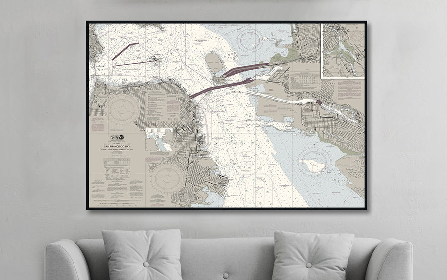


San Francisco Bay Candlestick Point to Angel Island Nautical Chart
$129.00
- Some frame styles may not accommodate certain sizes. If you see a size is "Unavailable" then try another frame type or size. For larger print sizes select "Gallery Wrap Canvas" as the frame type!
- To get a better view, click on a picture on the left to be able to zoom in and view the gallery.
- US Shipping is already included in all prices so no hidden fees during checkout!
San Francisco Bay is a large tidal estuary in the U.S. state of California and gives its name to the San Francisco Bay Area. It is dominated by the cities of San Francisco, San Jose, and Oakland. San Francisco Bay drains water from approximately 40 percent of California.
Candlestick Point was named for the "candlestick birds" (long-billed curlews) that populated the area for many years, due to Candlestick Park's location next to the San Francisco Bay.
Angel Island is a State Park and is a fantastic place to feel like you've escaped for the day. The island is only accessible by boat.
- Multiple sizes available
- Either printed on photo paper in a traditional frame
- Or printed on art canvas and stretched around a gallery wrap frame
- Will not fade or discolor and ready to hang
- Proudly made in the USA!